ShopDreamUp AI ArtDreamUp
Deviation Actions


Description
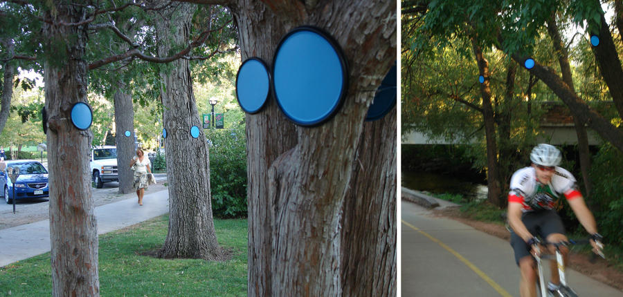
CONNECT THE DOTS : MAPPING THE HIGH WATER OF BOULDER CREEK
Three hundred blue markers placed along the creek that runs through the center of Boulder, Colorado mark the predicted flood water level. It allows the citizens of the city to measure this mark against their own bodies: depending on the topography, marks are ankle high in some areas, 18 feet above head in others.
The process of focusing on an ephemeral event outside memory or experience produces an alternative map of the city. Rather than claiming property or territory, it uses the infrastructure of the city - its bridges, stairs, streets and buildings - to create a three dimensional map which makes apparent the ever-changing presence of water. Instead of an abstraction, this mapping makes apparent the constancy of change through visceral experience.
The city of Boulder is located at the mouth of Boulder Canyon. Because of its location, the nature of the steep slopes and long approach upstream the city is highly susceptible to flooding. It is considered to be a high hazard zone, where the question is not if there will be a flood but when will it happen.
Image size
2670x1275px 1.39 MB
© 2010 - 2024 Mary-Miss
Comments2
Join the community to add your comment. Already a deviant? Log In
This is absolutely an awesome project with a real impact!
Brilliant idea whoever came up with it!
Brilliant idea whoever came up with it!